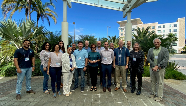
The NOAA CoastWatch Program in collaboration with CARICOOS and with the Department of Marine Sciences of UPR-Mayaguez hosted the NOAA CoastWatch Ocean Satellite Data Course during February 5- 7, 2020 at the Hyatt Place Hotel in San Juan, PR. Instructors from CoastWatch Regional Nodes across the Nation shared their expertise towards the discovery, access and analysis of remote sensing data: Cara Wilson and Dale Robinson from the West Coast Node; Joaquin Triñanes and Gustavo Goni from the Caribbean/Gulf of Mexico Node; Michael Soracco from the Central Node and Julio Morell from CARICOOS. Participants came to the course with a specific project to work on during the labs and a variety of datasets and software tools were provided by the instructors to complete these projects. Participants chose from among R, Phyton, Phyton Notebooks, ESRI ArcGIS, CoastWatch Utilities and the Panoply Viewer according to their individual background and expertise. The course emphasized the extensive CoastWatch ERDDAP remote sensing holdings as the main data source in the teaching sessions and for the participant projects. Excellent course!
For course updates check https://coastwatch.pfeg.noaa.gov/courses/satellite_course.html.