Website

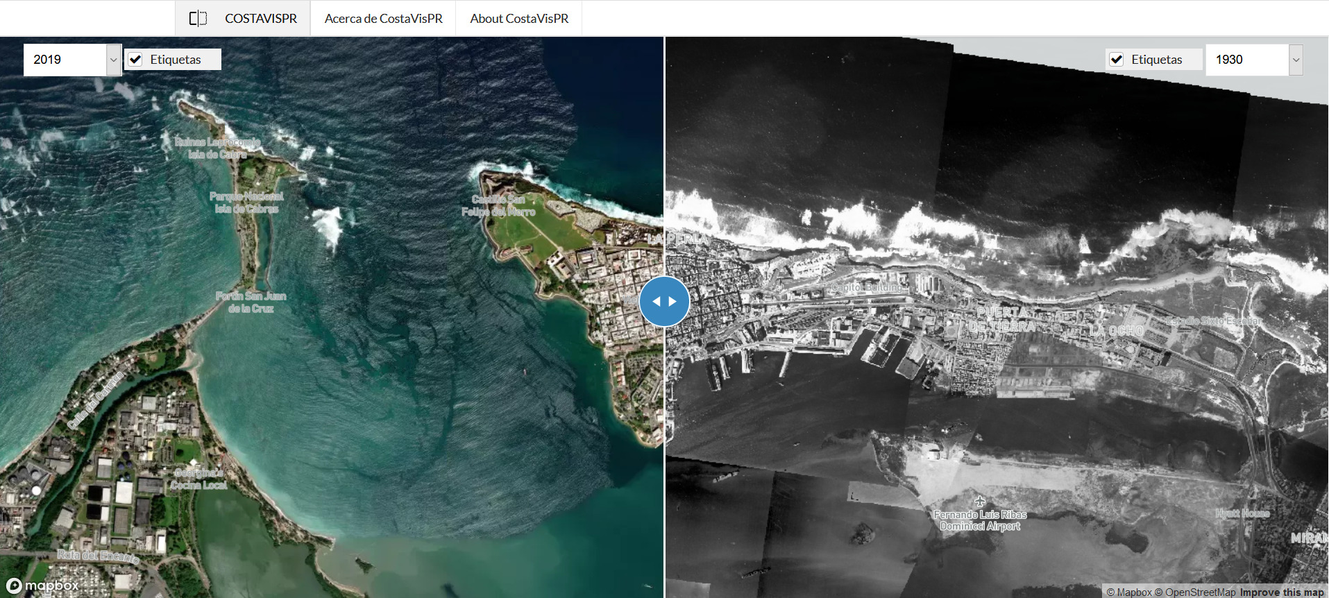
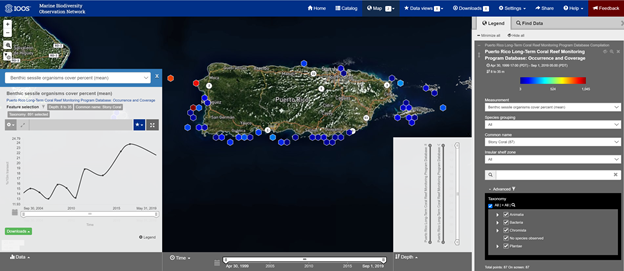
Visualization of Puerto Rico coral reef monitoring data in the Marine Biodiversity Observation Network data portal

The Puerto Rico Coral Reef Monitoring Program (PRCRMP) has been a joint effort between the PR Department of Natural and Environmental Resources (DNER) and NOAA’s Coral Reef Conservation Program (CRCP) to gather biological data on the status of benthic and fish assemblages since 1999. Datasets available include several measurements such as coral cover percent, fish… Read More

COSTAVISPR: A NEW CARIBBEAN REGIONAL OCEAN PARTNERSHIP TOOL TO EXPLORE COASTAL LANDCOVER CHANGES IN PUERTO RICO

CostaVisPR: Vista Aerea de la Transformacion Costera de Puerto Rico (http://www.costavispr.org) is a web-based tool for visualization of changes in coastal areas. This viewer integrates aerial photographs from 1930, 1950, 1994, 2010, 2017 and 2019 and allows exploration of changes in land cover, which can be related to natural and anthropogenic processes such as hurricanes, sea level… Read More costavispr.org

Rincón Wave Buoy back in the water!

The Rincón wave buoy has been redeployed just in time for the beginning of the hurricane season and the North Atlantic wave season. The buoy was out of the water for two weeks for maintenance and a complete refurbishment. The buoy, which sits at approximately 2 km off the Rincón lighthouse, monitors and records information… Read More

CARICOOS Buoys are Ready for the Hurricane Season

The hurricane season kicked off on Thursday, June 1st and is now officially underway in the Atlantic Ocean and Caribbean Sea. Our data buoys are back in the water to record the entire season. With support from the University of Maine’s Physical Oceanography Group and Commercial Divers Inc., CARICOOS staff performed the annual maintenance for the Ponce,… Read More

A View of Our Hurricane Season Dashboard

As the hurricane season comes to an end (or is it?), we look back on the new and improved hurricane season dashboard. We pulled the best products from the National Weather Service and other NOAA programs to provide you with a synoptic view of what’s going on in the Atlantic. This year we had almost 7000… Read More

Surface Currents Now Available at CARICOOS’ Main Map

They’re not hidden anymore! Surface currents are now displayed on the CARICOOS homepage. Just select Currents from the markers available on the bottom left of the map to see the latest surface current data as resolved by CARICOOS’ HFR network. Use the SCALE bullet to translate colors into current magnitude. You can also click on… Read More