Archive
Experimental Weekly Sargassum Inundantion Report by NOAA and University of South Florida- Status October 6-12, 2020
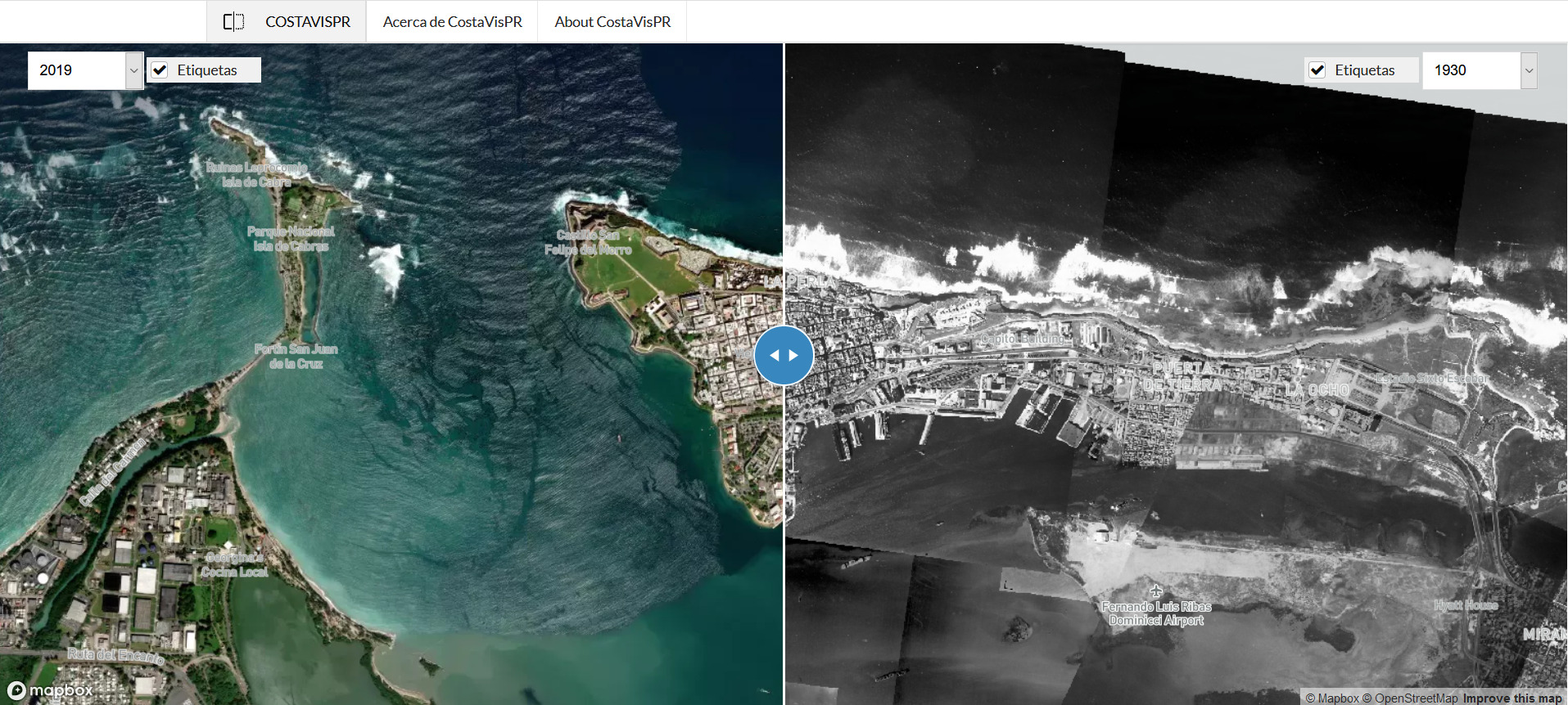
COSTAVISPR: A NEW CARIBBEAN REGIONAL OCEAN PARTNERSHIP TOOL TO EXPLORE COASTAL LANDCOVER CHANGES IN PUERTO RICO
CostaVisPR: Vista Aerea de la Transformacion Costera de Puerto Rico (http://www.costavispr.org) is a web-based tool for visualization of changes in coastal areas. This viewer integrates aerial photographs from 1930, 1950, 1994, 2010, 2017 and 2019 and allows exploration of changes in land cover, which can be related to natural and anthropogenic processes such as hurricanes, sea level… Read More
Outlook of 2020 Sargassum blooms in the Caribbean Sea and Gulf of Mexico* September 30th, 2020, by the University of South Florida Optical Oceanography Lab
In September 2020, the overall Sargassum amount further decreased across most of the central Atlantic. Moderate amount was still observed in the Central West Atlantic and most of the eastern Caribbean Sea.