Archive

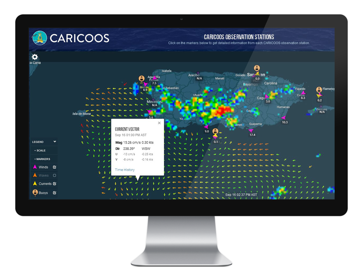
Surface Currents Now Available at CARICOOS’ Main Map

They’re not hidden anymore! Surface currents are now displayed on the CARICOOS homepage. Just select Currents from the markers available on the bottom left of the map to see the latest surface current data as resolved by CARICOOS’ HFR network. Use the SCALE bullet to translate colors into current magnitude. You can also click on… Read More

CARICOOS with the CIAPR Commission for Natural Disaster Management

The Commission for Natural Disaster Management of the College of Engineers and Land Surveyors of Puerto Rico (CIAPR) invited CARICOOS to participate in the workshop: Anticipating Surprises and Taking Action – The Integration of CIAPR to the Climate Change Council. Offered last August in Mayaguez, the workshop aimed at familiarizing engineers and land surveyors with… Read More

CARICOOS at Planeta Digital

CARICOOS was present at Planeta Digital – Mayaguez Mall. Produced by the Ecoexploratorio Science Museum, this mobile exhibit brought science, technology and nature to the local community. Topics on climate change, natural hazards, and emergency management were presented in a series of booths, talks, games, cinema, and others. CARICOOS participation focused on advising the public on the vast… Read More