A perspective for the Caribbean Sea and Gulf of America* by the University of South Florida Optical Oceanography Lab – (bbarnes4@usf.edu, yuyuan@usf.edu, huc@usf.edu)
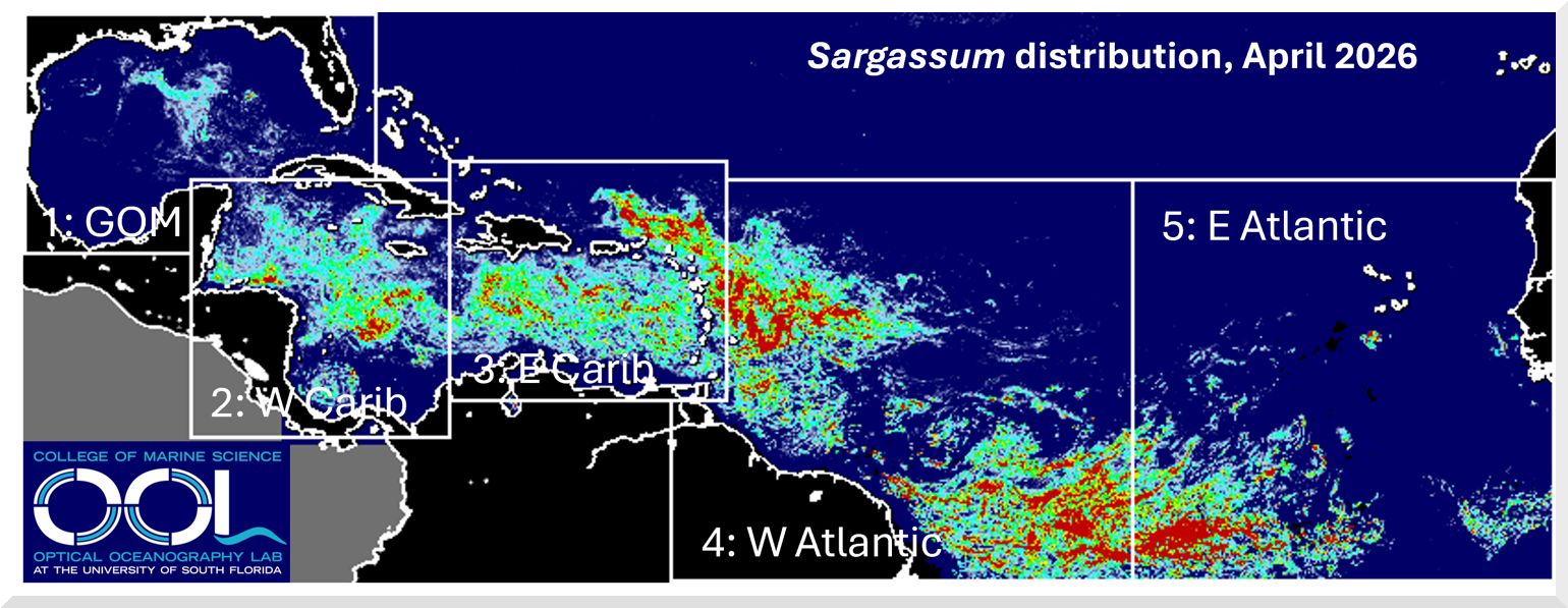
The map above illustrates the average Sargassum abundance for April 2026, with warmer colors indicating higher concentrations. The highest level (red) represents about 0.4% coverage of the ocean surface, meaning Sargassum clumps and mats are scattered throughout those areas. For each region, current abundance is compared to historical values from April 2011–2025 using the box-and-whisker plot below, where the horizontal lines within each box mark the minimum, 25th percentile, median (50%), 75th percentile, and maximum levels.
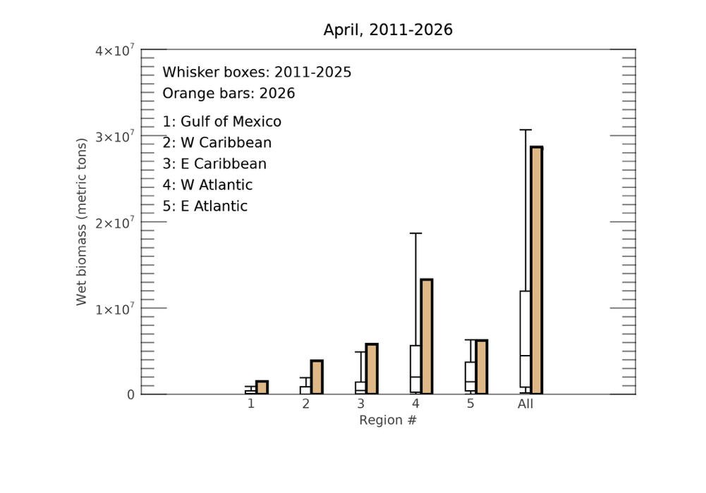
The upward trend observed in recent months has continued, leading to increased Sargassum across all regions shown on the map, with nearly every area reaching record-high levels for April. The three large Sargassum masses outlined on the map have also persisted. By mid-April, Sargassum had spread across the entire Caribbean Sea, with significant amounts transported into the Gulf. As a result, major beaching events likely occurred throughout the Caribbean and the Lesser Antilles, while moderate beaching was also reported along Florida’s south-east coast.
Looking ahead, Sargassum levels in most regions are expected to continue rising over the coming months. Beaching events across the Caribbean and along Florida’s southeast coast will likely persist and intensify, with additional occurrences possible along the coasts of Louisiana and Texas. The year 2026 is shaping up to be another major Sargassum year—defined by levels exceeding 75% of historical values—and could potentially set new records by the summer. Previous monthly bulletins and daily imagery are available through the Sargassum Watch System (SaWS). In addition, high-resolution Sargassum maps for selected coastal regions can be accessed in near real time under the “Satellite Data Products => High Resolution” section of the OOL website