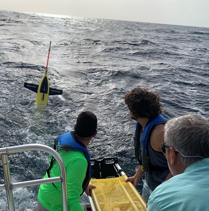
In June 2021, CARICOOS, in collaboration with NOAA-AOML, OCOVI and US Navy, deployed seven underwater gliders. Two of these were deployed in the tropical Atlantic Ocean and five in the Caribbean Sea off Puerto Rico and US Virgin Islands. These battery-powered AUVs operated for up to six months. During the mission, the gliders gathered temperature and salinity profile data (from surface to 900 m) for assimilation into hurricane intensification forecast models and further understanding enhanced air-sea interaction processes that drive hurricane intensification.
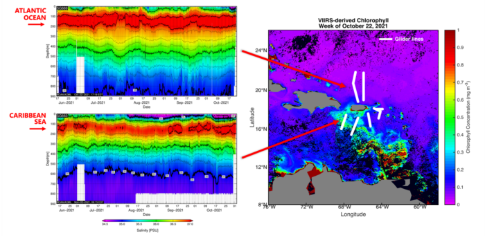
During this year, the gliders reported “lowered-than-usual” near surface salinities likely due to the entrainment of low-salinity and chlorophyll-rich riverine waters from the Orinoco and Amazon. Salinity observations at the Caribbean Sea showed a shallow low-salinity layer above 20 meters, with sea surface salinity of less than 34 for almost 3 months, while in the Atlantic Ocean an entrainment of low salinity was observed by the end of the hurricane season which is not that common. These less salty and warm waters form near surface barrier layers that have been linked to potential tropical cyclone intensification. These observations are key to effective responses to tropical cyclones that could save lives, property, and livelihoods.
Now we have our gliders back safely in our lab for refurbishment and getting them ready for the 2022 Atlantic Hurricane Season.
Historical data can be accessed through the IOOS Underwater Glider DAC map (https://gliders.ioos.us/map/#).