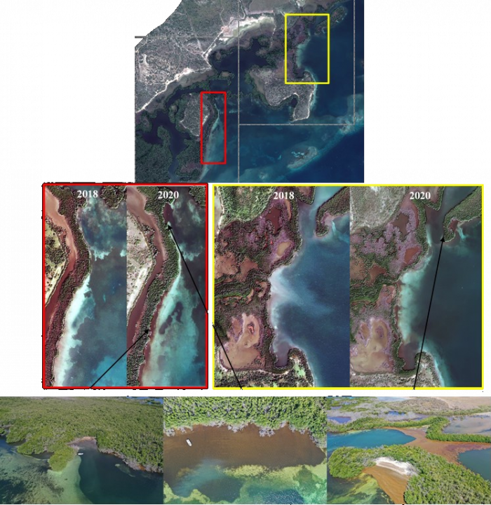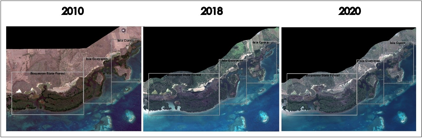
Since 2011, large accumulations of Sargassum on the coasts has become a challenge for managers. Some of the challenges include lack of access to ramps and beaches, deterioration in the quality of tourism services and impacts on coastal ecosystems dynamics. To address this issue, CARICOOS commissioned a study to evaluate changes in benthic composition and coastal vegetation in La Parguera area potentially resulting from to Sargassum influx and accumulations in cays, bays, inlets and near-shore environments. For this purpose, high-resolution satellite imagery was acquired from 2010 (before Sargassum inundations) and 2020. An additional image from 2018 was acquired to include the potential impacts of hurricanes Irma and Maria. Results show a negative trend in vegetation cover loss of 24% (or 546,446 square meters) from 2010 to 2020. In addition, a dramatic negative change in vegetation cover was observed from 2018 to 2020, especially for the Isla Cueva site (97%) and were consistent with the field observations and drone surveys conducted since 2018 in the area. Changes in benthic composition occurred mainly in mud and sandy bottom with submerged aquatic vegetation. This study provides for the first time, an assessment of the effects of Sargassum accumulation and hurricane events on these ecosystems.