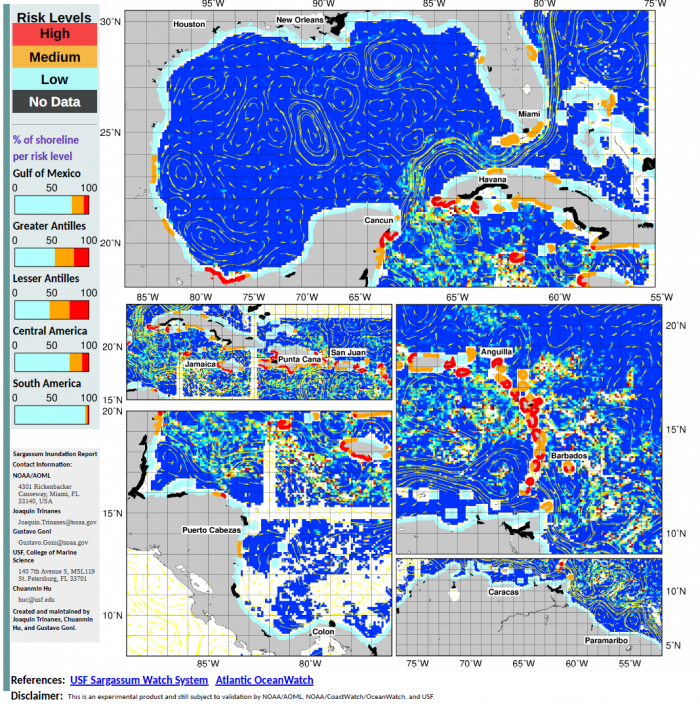
STATUS JUNE 9-15
Since 2011, large accumulations of Sargassum is a recurrent problem in the Caribbean Sea, in the Gulf of Mexico and tropical Atlantic. These ticevents can cause significant economic, environmental and public health harm. These experimental Sargassum Inundation Reports (SIR) provide an overview of the risk of sargassum coastal inundation in the Caribbean and Gulf of Mexico regions. Using as core inputs th AFAI (Alternative Floating Algae Index) fields generated by the University of South Florida (USF), the algorithm analyses the AFAI values in the neighborhood (50 km) of each coastal pixel and, computing the difference between those values and a multiday baseline, classifies the risk into three categories: low (blue), medium (orange) and high (red). In black are areas with not enough data. The two ad-hoc thresholds used for classification are 0.001 and 0.003. The vectors in the images represent the geostrophic currents.