Outlook of Sargassum Blooms – January 31, 2026
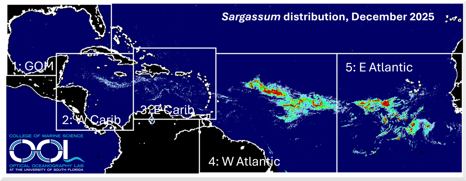
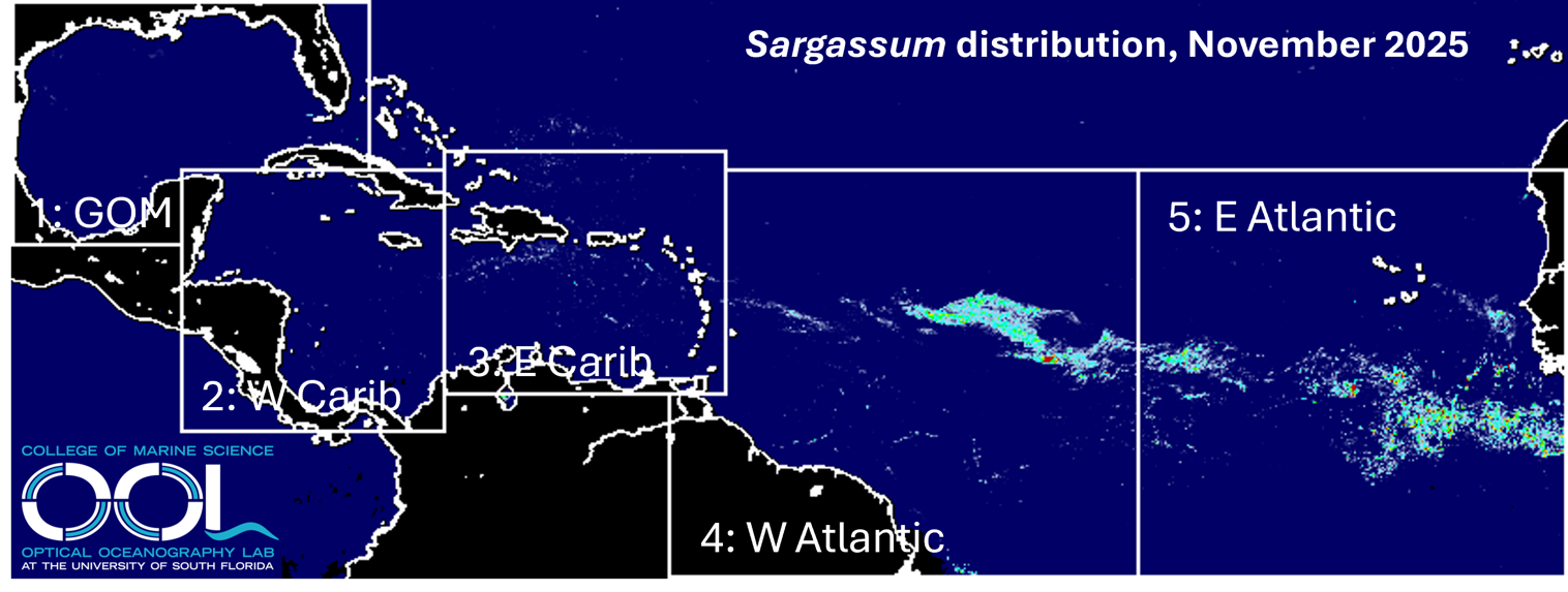
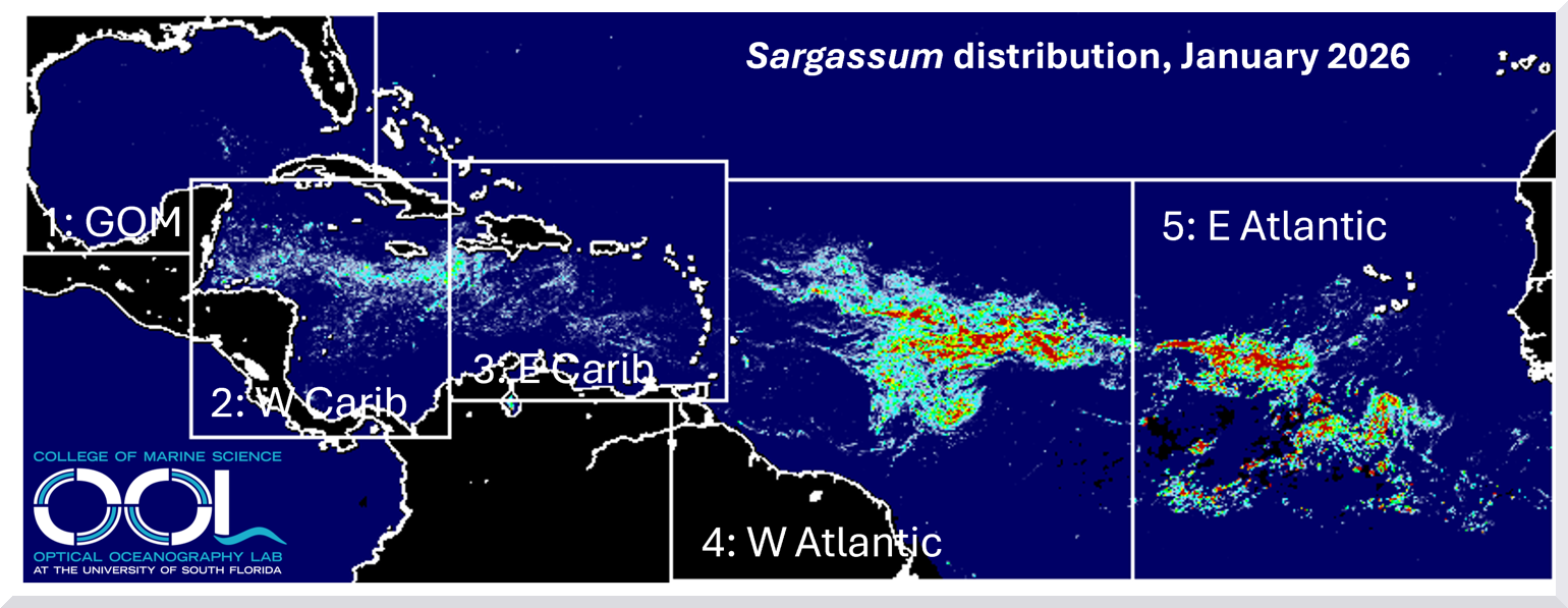
A perspective for the Caribbean Sea and Gulf of America* by the University of South Florida Optical Oceanography Lab – (bbarnes4@usf.edu, yuyuan@usf.edu, huc@usf.edu) The map above shows the average Sargassum abundance for the month of January 2026, with warm colors representing higher abundance. The top color (red) indicates that 0.4% of the ocean surface is… Read More