A perspective for the Caribbean Sea and Gulf of America* by the University of South Florida Optical Oceanography Lab – (bbarnes4@usf.edu, yuyuan@usf.edu, huc@usf.edu)
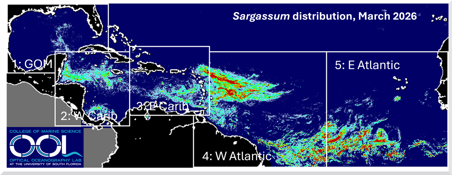
The map above shows the average Sargassum abundance for March 2026, with warmer colors indicating higher concentrations. The highest level (red) represents about 0.4% of the ocean surface covered by Sargassum, meaning clumps and mats are scattered throughout the area. The abundance in each region is compared with historical data from March (2011–2025) using the box-and-whisker plot below, where horizontal lines within each box represent the minimum, 25th percentile, median (50%), 75th percentile, and maximum values.
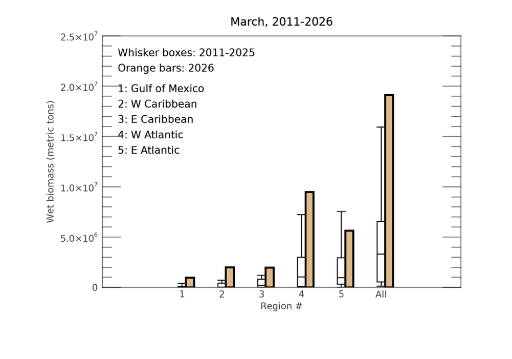
As predicted last month, Sargassum continued to grow and drift westward, leading to increased amounts across all regions shown on the map. With the exception of the eastern Atlantic, every region recorded historically high Sargassum levels for March. The distribution still shows three distinct large masses located in the eastern Atlantic, western Atlantic, and western Caribbean (including the Gulf). Significant beaching events have likely occurred in the western Caribbean—particularly along the coasts of Belize, Honduras, and the Mexican Caribbean—as well as around the Lesser Antilles.
Looking ahead, Sargassum levels are expected to continue rising in most regions over the coming month. Beaching events will likely persist in both the western and eastern Caribbean. The Florida Keys and Florida’s southeast coast may experience moderate beaching as Sargassum from the Gulf is transported toward these areas. Overall, 2026 is shaping up to be another major Sargassum year—defined by levels exceeding 75% of historical values—and could potentially become a record-breaking year by the summer.