The 2024 Hurricane Glider Mission in the Caribbean region has successfully concluded, providing valuable insights into hurricane research. Autonomous underwater gliders collected oceanographic data, including the thermal structure and salinity profiles of upper ocean layers, which are key factors in understanding tropical cyclone intensification.
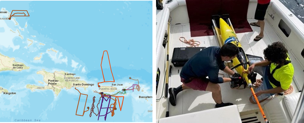
Nineteen (19) gliders were deployed across the Caribbean Sea and tropical Atlantic Ocean (Figure 1). These included one (1) glider operated by CARICOOS in the Caribbean Sea; five (5) gliders operated by NOAA-AOML in collaboration with CARICOOS and ANAMAR in the Caribbean Sea and tropical Atlantic; six (6) gliders operated by the U.S. Navy in partnership with CARICOOS and OCOVI in the tropical Atlantic; two (2) gliders operated by NOAA-AOML in partnership with the Cape Eleuthera Institute (CEI) in the tropical Atlantic; and seven gliders operated by the University of the Virgin Islands (5) and Rutgers University (2) in the Caribbean Sea. Over the course of six months, more than 17,200 temperature, salinity, and oxygen profiles were recorded, covering a distance of over 19,650 kilometers

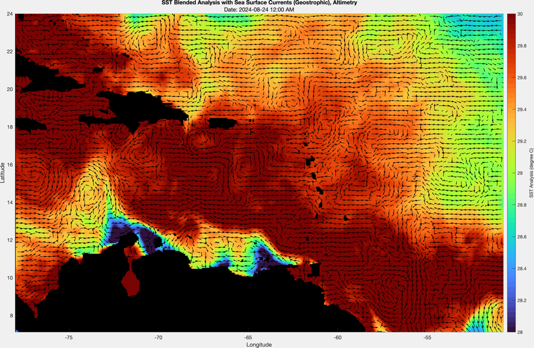
This 2024 Atlantic hurricane season experienced sea surface temperatures in the US Caribbean waters exceeding 30°C, mostly driven by ocean heatwaves (Figure 2). These warmer-than-average conditions highlighted the significant influence of persistent heat anomalies on the region’s oceanic and atmospheric systems. Mesoscale eddies, spanning 10–100 km in diameter, were observed transporting heat and nutrients while altering the thermocline’s depth, further amplifying temperature changes (Figure 2).

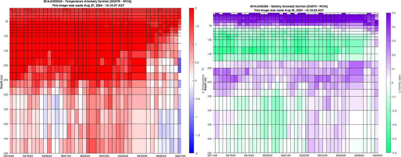
The gliders detected temperature anomalies of +2°C in the Caribbean and +1°C in the Atlantic, extending to depths of 500 meters. These anomalies, attributed to ocean heatwaves and mesoscale eddies, highlight significant shifts in water circulation and heat distribution. The positive temperature anomaly also extended into the subtropical underwater layer, characterized by high salinity at approximately 150 meters. Concurrently, a decrease in salinity was observed, indicating significant changes in the ocean’s physical state during this heatwave event. These conditions persisted for several weeks.

The gliders also tracked freshwater plumes from the Amazon and Orinoco Rivers spreading into the western tropical Atlantic and eastern Caribbean. These interactions revealed notable changes in salinity and temperature during persistent ocean heatwave conditions, affecting the ocean’s physical state.
The data collected provided valuable insights into how the ocean influences storm development; helping to refine early warning systems and better equip people with reliable information to prepare for tropical cyclone events.


